
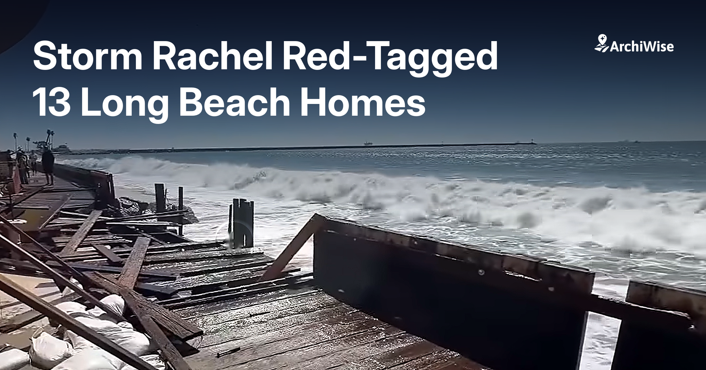

On Friday, October 9, the City of Long Beach ordered residents of nine oceanfront properties to evacuate as waves driven by the remnants of Tropical Storm Rachel broke through the boardwalk’s bulkhead on the Peninsula. The affected stretch covered two blocks between 64th and 66th Places.
By Saturday evening, Mayor Rex Richardson confirmed that inspectors had red-tagged eight buildings containing 13 residences, with one more building yellow-tagged, all in the 6400 and 6500 blocks of Seaside Walk. A red tag means the structure is too dangerous to enter. Tides reached roughly 7.5 feet on Saturday and close to 8 feet on Sunday morning, with waves running four to seven feet and a coastal flood warning in place from Malibu to Long Beach. Nearby, Newport Beach saw street flooding over the same weekend.
The city distributed about 17,000 sandbags during that storm alone, and roughly 24,000 across three recent storms. A $230,000 emergency sand push began immediately, ahead of a full $11.4 million dredging project that started the week of October 19. Broader evacuation advisories were lifted on Sunday, October 11, though orders remained for the 6400 and 6500 blocks of Seaside Walk, with inspectors checking the affected homes twice a day as the tide cycles continued.
This is the second major coastal event the state has braced for this season – we covered the wider picture in California Declares State of Emergency Ahead of a Historic El Niño.
What the flood map showed before the storm
Here is the part that matters for anyone buying land or housing stock on a coast.
Pull up a parcel on 64th Place and the flood designation was already there, long before Rachel formed. The FEMA National Flood Hazard Layer classifies this block as Zone AE – a Special Flood Hazard Area, described in the federal data as an area with high flood risk, carrying a mapped base flood elevation of 8 feet under Digital FIRM panel 06037C.
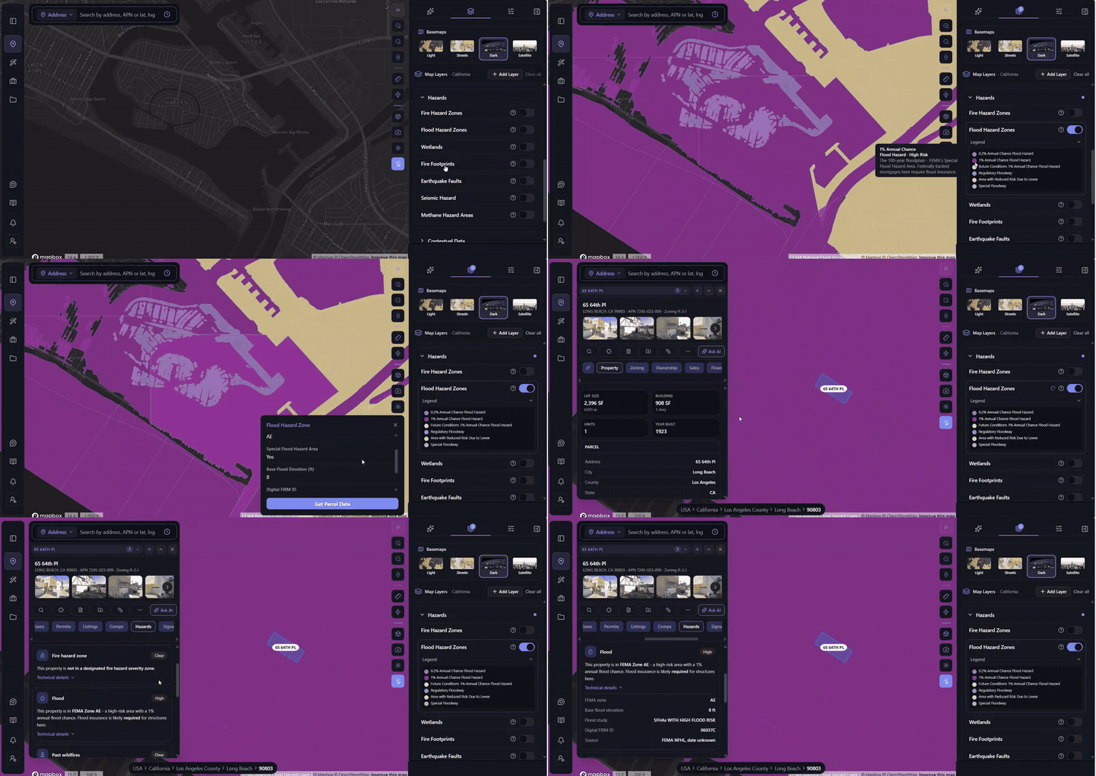
None of that is hindsight. It is a published federal designation that existed on the map before anyone made an offer on these homes.
A Zone AE label does not predict which night a bulkhead fails or which building gets a red tag. What it does tell you is that the parcel sits inside the area FEMA expects to flood in a one-percent-annual-chance event, and that every downstream consequence of that designation applies to whatever you build there.
Why the designation changes the deal, not just the risk
Developers sometimes treat a flood flag as a weather problem. It is closer to a financing and entitlement problem.
A property inside a Special Flood Hazard Area with a federally backed mortgage triggers mandatory flood insurance. Lenders enforce it, and the premium runs for the life of the loan. New construction has to meet elevation requirements tied to the base flood elevation, which reshapes your ground floor, your parking, your mechanical placement and your cost per unit. You will need a floodplain development permit on top of your normal approvals. And in California, a Special Flood Hazard Area must be disclosed to the buyer on the Natural Hazard Disclosure Statement when you sell, so the flag follows the asset all the way to exit.
Any one of those can move a pro forma. Discovering all four after you are in escrow is how a site that penciled at acquisition stops penciling at permit. Our hazard risk assessment guide breaks down which flags carry this kind of weight and which are noise.
The maps are not fixed
It is worth saying plainly: a parcel that is not in a high-risk zone today is not permanently outside one.
FEMA revises its flood maps, and revisions add newly mapped high-risk areas as often as they remove them. Communities and owners also petition for changes through the map revision and amendment process. For a developer holding land through a multi-year entitlement cycle, the designation you diligenced at acquisition is not guaranteed to be the designation you build under. Checking once, at the start, and never again is its own form of exposure.
Checking it before you commit
Flood designation is one of the cheapest things to verify and one of the most expensive to miss – a point we made in The Risks Beneath Your Site, and one this storm has made for us.
In ArchiWise, the flood data sits on the Hazards layer, so you can switch it on across a map view and see which blocks in a target area carry a high-risk designation before you shortlist anything. Open a specific parcel and the Hazards tab returns the flood classification, the FEMA zone, the base flood elevation and the FIRM panel for that address, alongside the Property, Zoning, Ownership, Sales, Financing, Taxes, Permits, Listings, Comps, Signals, Area and Incentives tabs for the same parcel. If you are screening at volume rather than checking one address, a flood filter removes high-risk parcels from the result set, so a coastal search comes back without the sites you were going to reject anyway.
That is a few seconds of work per parcel. The alternative is finding out from a tide chart.
Rachel will not be the last storm to put a Southern California block on an evacuation list. The flood designation on the next affected parcel is, in all likelihood, already published – sitting on a map, waiting for somebody to look at it before they sign. If you want to see where that check fits into the wider workflow, our AI site selection page walks through it from the first search onward.